


Voting District 1477070000002, St. Clair County, Michigan
About
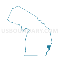
Outline

Summary
| Unique Area Identifier | 599424 |
| Name | Voting District 1477070000002 |
| County | St. Clair County |
| State | Michigan |
| Area (square miles) | 22.08 |
| Land Area (square miles) | 22.05 |
| Water Area (square miles) | 0.03 |
| % of Land Area | 99.86 |
| % of Water Area | 0.14 |
| Latitude of the Internal Point | 42.85839350 |
| Longtitude of the Internal Point | -82.58015940 |
Maps


Graphs
Select a template below for downloading or customizing gragh for Voting District 1477070000002, St. Clair County, Michigan


Neighbors
Neighoring Voting District (by Name) Neighboring Voting District on the Map
- Voting District 1471372000002, St. Clair County, MI
- Voting District 1471554000001, St. Clair County, MI
- Voting District 1471752000001, St. Clair County, MI
- Voting District 1471752000003, St. Clair County, MI
- Voting District 1474316000003, St. Clair County, MI
- Voting District 1477070000001, St. Clair County, MI
- Voting District 1478290000001, St. Clair County, MI
Top 10 Neighboring County Subdivision (by Population) Neighboring County Subdivision on the Map
- Kimball township, St. Clair County, MI (9,358)
- St. Clair township, St. Clair County, MI (6,817)
- Casco township, St. Clair County, MI (4,105)
- Columbus township, St. Clair County, MI (4,070)
- China township, St. Clair County, MI (3,551)
- Wales township, St. Clair County, MI (3,248)
Top 10 Neighboring Unified School District (by Population) Neighboring Unified School District on the Map
Top 10 Neighboring State Legislative District Lower Chamber (by Population) Neighboring State Legislative District Lower Chamber on the Map
Top 10 Neighboring State Legislative District Upper Chamber (by Population) Neighboring State Legislative District Upper Chamber on the Map
Top 10 Neighboring 111th Congressional District (by Population) Neighboring 111th Congressional District on the Map
Top 10 Neighboring Census Tract (by Population) Neighboring Census Tract on the Map
- Census Tract 6346, St. Clair County, MI (5,554)
- Census Tract 6516, St. Clair County, MI (4,070)
- Census Tract 6341, St. Clair County, MI (3,807)
- Census Tract 6410, St. Clair County, MI (3,551)
- Census Tract 6526, St. Clair County, MI (3,248)
- Census Tract 6402, St. Clair County, MI (2,398)
- Census Tract 6406, St. Clair County, MI (2,353)
- Census Tract 6511, St. Clair County, MI (1,927)
Top 10 Neighboring 5-Digit ZIP Code Tabulation Area (by Population) Neighboring 5-Digit ZIP Code Tabulation Area on the Map
- 48079, MI (12,304)
- 48074, MI (9,356)
- 48054, MI (7,339)
- 48064, MI (4,107)
- 48063, MI (4,070)
- 48027, MI (3,249)